Monthly Archives: April 2016

Old Prince George Floodplain Map

flood

Just thought I’d share a cool looking old map overlay I found digging through the BC Map Services. I enjoy the very detailed, yet simple look. I’ve also superimposed the City of Prince George Flood Plain 1997 layer, which I think is the digitized version of the scanned BC map. Kinda scary to see how far up Patricia/Winnipeg/17th/Massey it would flood, but I guess the City’s got it figured out.

UrtheCast Satellites

urthecast

I’m working my way through the UrtheCast API documentation, and got side-tracked into making a satellite tracker map. This map shows the ten most recent locations of four satellites (ISS, Deimos-1, Deimos-2, and Lansat-8) and their imagery swaths, I think. The reason I say I think is that the call for the imagery swaths (or the forecast) is set for the future, although the returned timestamps appear to be in the past.

I also think I figured out how to hide my UrtheCast api key and secret from prying eyes through a PHP proxy, but I could also be wrong about that! If you can see them, let me know. 🙂

WMS GetFeatureInfo Request

geomet_getfeatureinfo

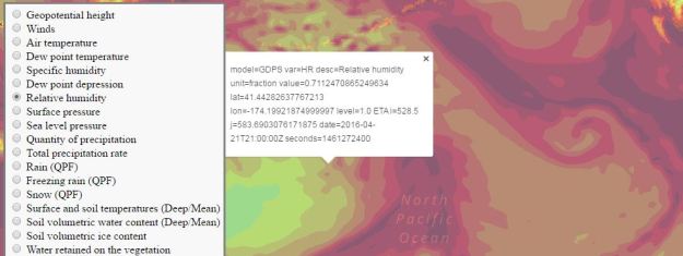
Continuing on with yesterday’s exploration into GeoMet and its myriad web mapping services (WMS), today I added GetFeatureInfo requests (map here).

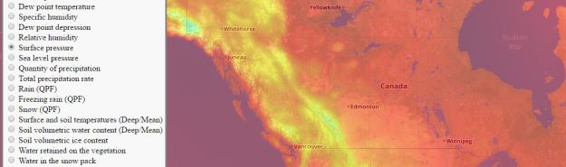
If you’ve used WMS, you’re probably familiar with GetCapabilities (retrieves metadata) and GetMap (retrieves map tiles) requests. GetFeatureInfo is another type of request which retrieves attribute information at a given location, provided the server (e.g. GeoMet) has been configured to provide this information (look for “queryable=’1′ ” in the layer metadata).

One stumbling block I encountered (and likely handled poorly) was overcoming the issue of cross-origin resource sharing (CORS). No matter what I tried, I was blocked from retrieving the request response because, of course, my webpage resides on a different server than the WMS. I got around this by calling a PHP script that copies the text response from the request locally and reads that version. Honestly, I’m not sure why that works and reading the original request doesn’t, but it does and that’s good enough for me. If you have a simpler solution (I’m sure it’s out there), I’d love to learn about it!

GeoMet: Canadian Weather WMS

geomet

I’ve been looking into Canadian open data, and stumbled across GeoMet Geospatial Web Services, which is a HUGE collection of weather-based web map services and KMLs. You can check out my sample map here, which contains a very tiny sampling of the available WMSes.

2011 Canadian Census Profile, By Province

census

As so often is the case with these side-projects, I blindly followed my nose to produce this map, which maps the 2011 Canadian Population Census, Census Profile (data here). There are 472 attributes in all, dealing with population, age, sex, dwellings, families, marital status and language.

The province squares idea came from Bill Dollins’ US States as Squares project, although I could have just as easily used the province boundaries.

I’m still definitely learning Mapbox JS – feel free to leave tips in the comments!


Achievement Unlocked! (map edition)

achievement

sparkgeo caught my attention with a blog post demonstrating Maptiks activities and conversions.

I’m curious to see how Maptiks will handle my new map, where nearly everything the user does is a conversion of some sort (or maybe none of them are conversions or maybe just viewing the map is the conversion, I’m not sure). I plan to add more achievements as time goes by, but for now, see how many achievements you can unlock!

Obvious inspiration: Achievement Unlocked! (one of my all-time favorite online games)

Top 499 Riskiest Railway X-ings in Canada

railway

The CBC has launched an investigative story headlined, “Transport Canada list of 500 ‘highest risk’ railway crossings not widely shared.” The story also includes an interactive section that seems to go out of its way to make it difficult to get a full picture of the crossings (it lets you search for nearby or top 25 crossings only).

Here is a map showing 499 of the highest risk railway crossings in Canada – there were no coordinates for one of the crossings. The data can be downloaded here.